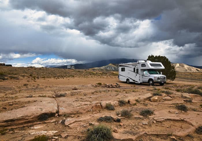
We camped at Escalante Canyon Road, Colorado in October 2021
Our previous stop: Rabbit Valley Camping Area Colorado Review & Camping Info
Campground Info
Location: 38.778775, -108.250140
Cost: Free
Camping Limit: 14 Day
Amenities: None
Related: Save 50% On Campgrounds All Over The United States With Passport America
Essentials Nearby
Town: Delta, CO – 12 miles
Gas Station: Phillips 66 – 9 miles
Dump Station & Potable Water: Confluence Park – 10 miles (Free Dump & Non-Potable Water. No Drinking Water)
Grocery Store: Walmart – 13 miles
Cell Phone Service
Verizon – Good
AT&T – Good
Nearby Attractions
Escalante Boat Ramp – 2.3 miles
Escalante State Wildlife Area – 12 miles
Confluence Park – 13 miles
Sweitzer Lake State Park – 14 miles
Black Canyon of the Gunnison National Park – 44 miles
Colorado National Monument – 33 miles
Grand Junction, Colorado – 29 miles

Escalante Canyon Road Free Camping Info
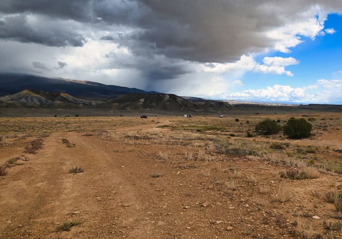
While the Escalante Canyon Road is quite long and has a few free campsites along it, most of the campers we saw were down the road to the right about 1/2 a mile from the highway entrance.
The road to the right starts out as a large open area that’s big enough for a few campsites.
The road then gets smaller and there are about 3 decent sized pull-offs along it that are good enough for motorhomes or trailers.
Related Product: We level our RV with the innovative Andersen RV Leveling Set (click to view on Amazon)

If you continue down this small side road you can get to some pretty amazing campsites along the rim of the Colorado River but it requires a vehicle with good clearance.
There’s also a small road to the left about a 1/2 mile from the highway entrance where there’s at least one large campsite for big rigs with some smaller sites up on the hill.
See Also: Best RV Shower Heads That Increase Water Pressure

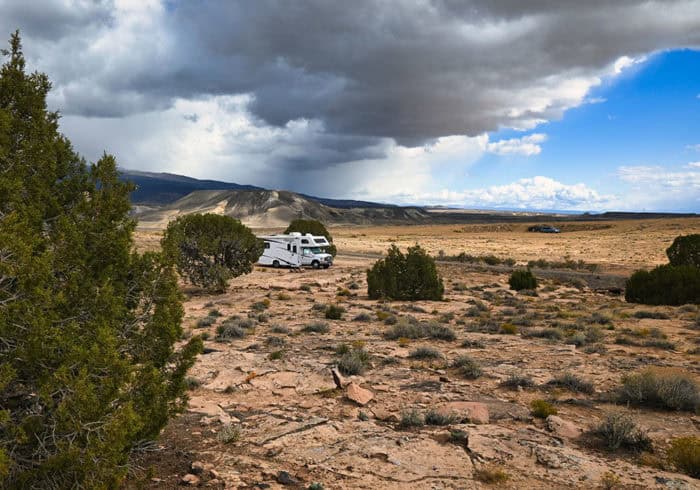
All of the main motorhome and trailer sites were taken when we got there on a Friday in October. Luckily for us, there was a small site open just down the road from the main camping area.
The coordinates are 38.777959, -108.250678. It was a very small site next to a tree but our 24 foot RV fit perfectly and we had no problem getting in and out of the site.
It was in a beautiful spot and even though it was close to the main dirt road it still felt fairly private and there wasn’t much noise at night.
See Also: What Is The Best RV Stabilizer System?
Escalante Canyon Road Free Camping Review
While there aren’t a ton of easily accessible campsites in this free camping area it’s still an excellent place to camp with lots to do.
There are tons of trails that run all over the entire area. Some are for OHV traffic while others have been recently closed to motor vehicles making them perfect for hiking and mountain biking.
We were able to follow a small trail from our campsite to the rim of the canyon the Gunnison River flows in.
We were able to get a good look at the boat ramp and it seemed like there were some spots for RVs even down by the river.
If you decide to try and find a spot near the Gunnison River just know that train tracks do run along the river and there are trains running daily and nightly.
See Also: Best RV Cell Phone Boosters That Actually Boost Signal
We also saw a ton of small tent campsites up near the rim. I think you can access them by following the road to the right I was talking about.
Some of the roads that lead to these sites had signs posted that they were closed to motor traffic so be careful where you drive.
I recommend this free camping area as a place to stop to rest for a few nights while traveling. There is some hiking and biking to do in the area but as far as nice campsites go the space is very limited.
If you need fast data speeds the further up the hill you camp the better the cell phone service will be. At our campsite, which was lower down, the cell phone service was pretty poor.
Have any questions about camping at Escalante Canyon Road in Colorado? Leave a comment below.


Please check your rivers. The main river is the Gunnison which empties into the Colorado River in the town of Grand Junction CO. The smaller waterway is the Escalante Creek. I find Escalante Road running SW toward Utah. Where were the railroads? Yes, there are some in Grand Junction.
Hi Kelly,
Thanks for the info about the rivers. I’ve changed the post so it’s correct.
The railroad runs along the Gunnison river in the canyon. There’s a spot where it crosses the road here (38.758160, -108.257438).